San Francisco historic maps
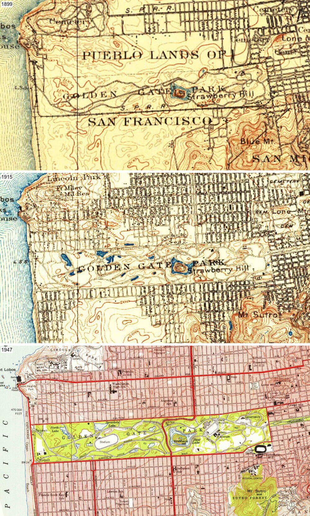
When I moved to San Francisco, I was fascinated to learn how much the city’s geography has been modified by humans. Similar to Seattle (where I moved from), the city was substantially regraded around the turn of the last century, with some of its coastal hills leveled to fill in wetlands and expand its human-habitable footprint into San Francisco Bay. The western half of the city was largely covered by sand dunes before the creation of Golden Gate Park and deliberate development of the Sunset and Richmond neighborhoods.
It’s one thing to read about this online, but how can we visualize it?
The United States Geological Survey maintains a great library of historical topographic maps dating back to the 19th century. (If you’re looking for something to restore your faith in public services and open data, be glad that this exists!)
Check it out here! By aligning the maps of San Francisco, we can create a scrollable view of the city’s streets and coastline over the decades. (The alignment info an imagemagick commands are available here.)
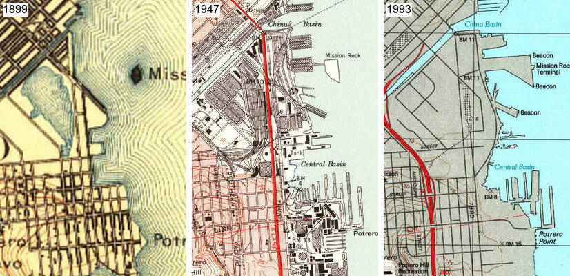
Residents of Dogpatch and Potrero Hill may be interested to see the famous long bridge subsumed by landfill, while Mission Rock gradually becomes encased in cement and tethered to the mainland (Mission Rock Resort and The Ramp are situated approximately in the center of this tile).
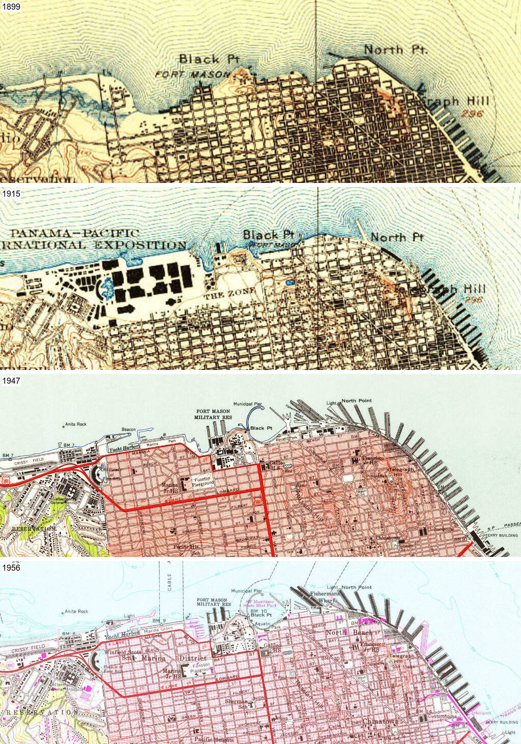
The northern waterfront was even more substantially reshaped. The 1915 Panama Pacific International Exposition, showcasing the city’s rebirth after the 1906 earthquake, led to the creation of the neighborhood now known as the Marina. The Palace of Fine Arts is the sole survivor of its pavilions. The aquatic park and the city’s northern piers around Fisherman’s Wharf achieve their final form by the mid 1950s.
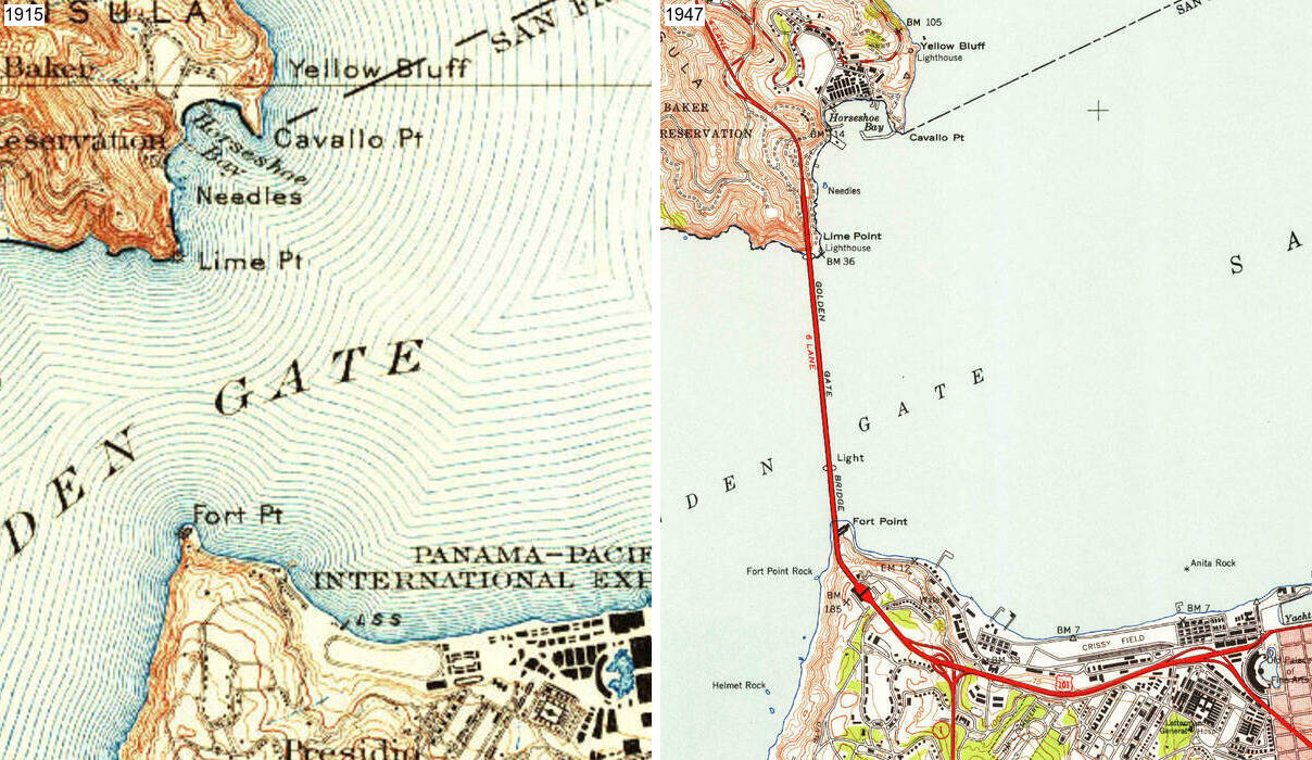
The Golden Gate Bridge and the highway system arrive in 1937.
Simultaneously, the Outside Lands explode into being in the first half of the 20th century.